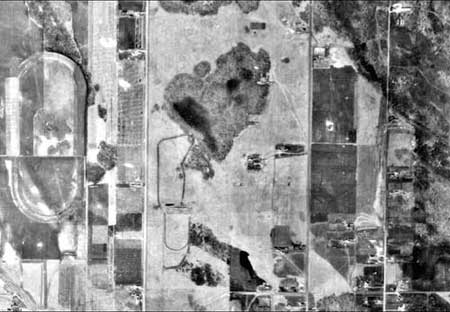
1949
The area is populated by small agricultural holdings and farmsteads. The native prairie surrounding these farms was used extensively as "pastureland" by the numerous small dairies and horse farms in the immediate area. Trails and even a small track and riffle range exist on the native prairie. Cropland is also a major land use at this time. The abandoned Horse Race Track (circa 1912) is still evident although crops have been established on this property where ponding and wetland permit.
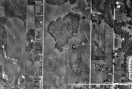
1958
Most of the farmsteads of 1948 still exist, however a significant housing development has been established on the SE quadrant of the map. Existing prairie has been replaced by cropland in the area of the old race track in the W quadrant of the map. And forest in the NW quadrant has been replaced by prairie.
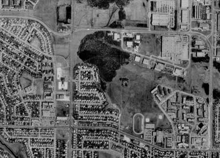
1979
Extensive housing development has replaced most of the farmstead properties and local dairies have been amalgamated or eliminated. The boundary of the Living Prairie Museum has been clearly established (circa 1974) with the school and housing development. The old Race Track on the NW quadrant is still evident with the shape of the street layout. Prairie in the N quadrant has been replaced by industrial development or reverted to maintained green spaces.
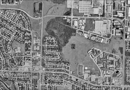
2002
The map indicates the current threat to the existing prairie remnants which is industrial development. Most of the remaining remnant prairie with the exception of the Living Prairie Museum is not zoned as park or public reserve or endangered green space and so is subject to Industrial Development and road infrastructure.